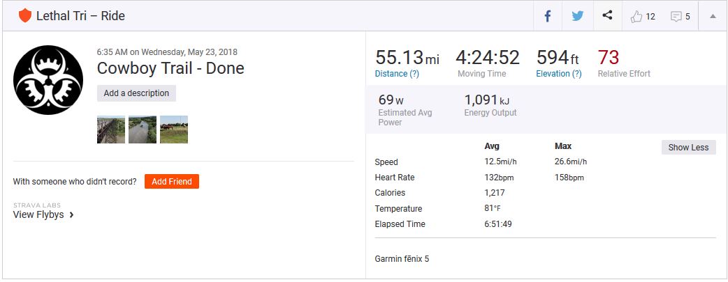
Goal #22 on my 29 Before 29 list was to bike the Cowboy Trail. I had heard about the trail from a former railroad coworker. The Cowboy Trail used to be a rail line for the Chicago Northwestern and was converted to a bike trail in 1996. It’s 195 mile of crushed gravel and extends from Norfolk, NE to Valentine, NE. This was my first multi-day, unsupported bike ride.
My Schedule
I started in Tilden, about 20 miles into the the trail, since I could leave my car with friends who live there. On Day 1, I rode from Tilden to O’neil (57 miles). Day 2, O’neil to Long Pine (61 miles). Day 3, Long Pine to Valentine (55 miles).


Trail Quality
I thought the trail was in great shape! I had read reports on the forum that said otherwise but only experienced a couple rough sections. I didn’t come across any sand burs that were mentioned in a lot of other posts. The trail was slow moving overall, a result of the gravel being either wet or deep. It felt like riding through sand. Not a whole lot of packed down sections.
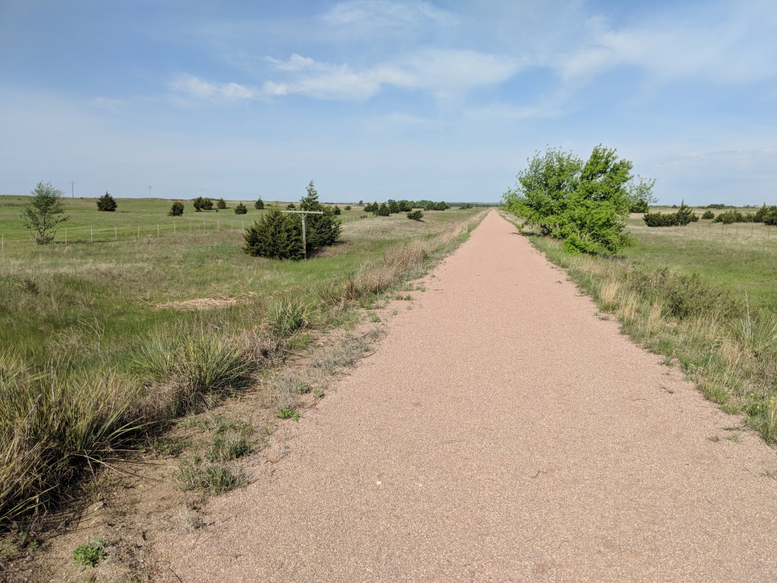
If the trail was slow moving, or if I wanted to just go faster, I would hop onto the highway. Highway 20 parallels the trail the entire way and has a large shoulder with rumble strips. Drivers were very courteous, even switching to the far lane when passing

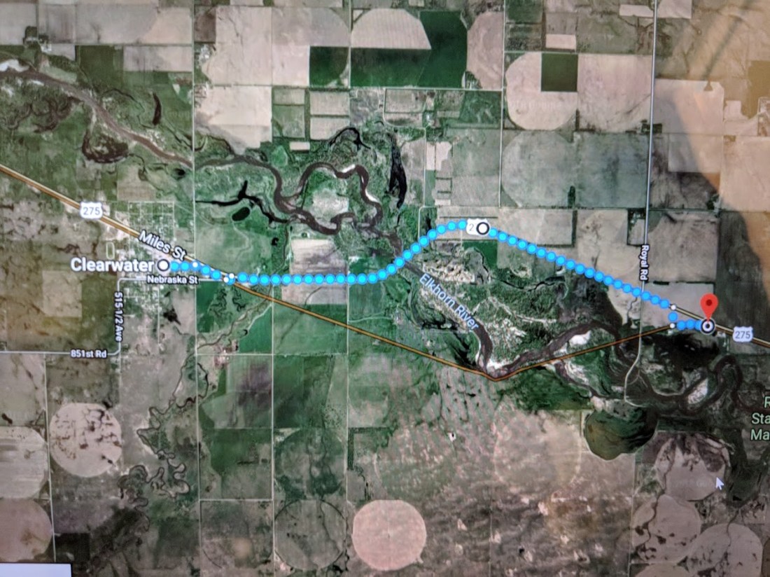
There’s a bridge out over the Elkhorn River between Neligh and Clearwater. The detour is to hop on the highway just east of Clearwater and get back on the trail in town.
Weather / Environment
The weather was good, no rain while I was riding, but the trail was was wet two mornings from the previous night’s rain. It was hot though, getting up to 85 degrees all three days, and leaving nice sunburns despite my use of sunscreen. I’d definitely recommend getting an early start to take advantage of the cooler temps.
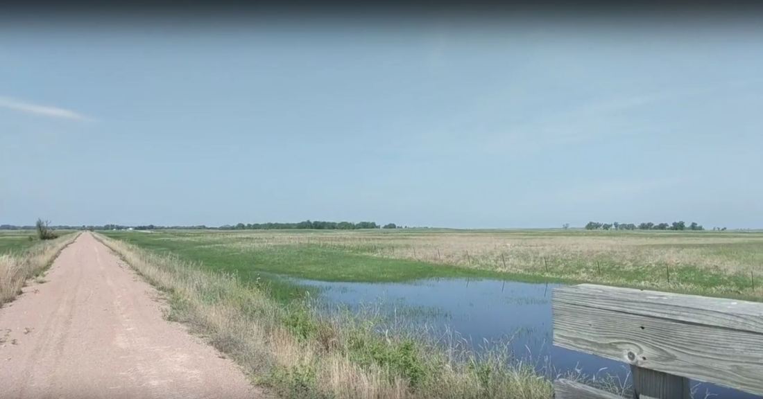
Bugs were nonexistent when I went, but I could see how they would get bad. There’s lots of standing water along the trail, which looked like flooding, but I was told it’s just a result of a high water table in the region.

My Bike
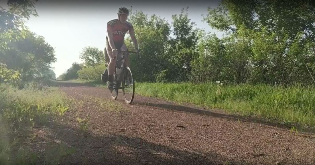
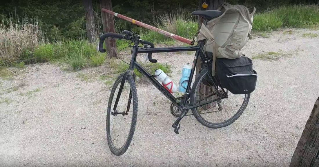
I rode a Dawes Lightning which was the perfect bike for the job. It’s the cheapest cross bike you can find on bikesdirect.com and has knobby 700×28 tires. I wouldn’t recommend a road bike, as there are parts where I encountered deep gravel as well as country road crossings with tire ruts. I only got one flat, and only realized it after filling up on the third day and finding a tire completely flat three days after finishing. My bike had a rear rack with some cheap panniers from Amazon which worked great. I also had a backpack, which I was initially wearing, but quickly caused back pain. I fixed that problem by rigging it to my seatpost and rear rack.
Food and Lodging
There are small towns every 10 miles along the trail. Most towns have gas stations with snacks or a bar with some real food. As you’d expect, the larger cities (O’Neil, Ainsworth, and Valentine) have much more dining options. The bikecowboytrail.com website was a great resource. You should plan ahead at every town. I ran out of water twice not planning ahead.

For lodging, I stayed in O’Neil at Elms Motel ($45/night) and in Long Pine at the Bunk House ($35/night). I’d recommend both of them, assuming you prefer low prices over five star amenities.

People
Fantastic! As a 6’6″ guy walking around small town Nebraska in his cycling spandex, I’m sure I stood out, but everyone was very friendly. I ate dinner with the city council president in Long Pine and had breakfast with some retired folks in Ainsworth.
Transportation
I utilized the Panda Shuttle to get back from Valentine to Tilden. Price was like $1.50 per mile, so about $245 for my return trip. Scheduling was the most difficult part, making plans late lead to not being sure if I had a ride back until I arrived in Valentine. You can reach the Panda Shuttle at (402) 376-6614. If you get the voicemail for Heart City Heating and Plumbing then you’ve called the right number.
My Experience
I had the trail all to myself the three days I was out there, only coming across one other cyclist and one guy who appeared to be hiking the trail. The remote sections where the trail diverged from the highway were very scenic, but when the trail paralleled the highway I was tempted to just hop on the highway.
 `
`
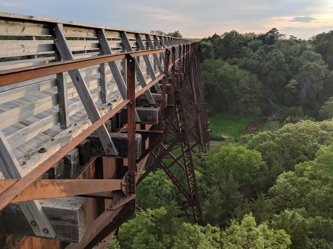
The bridges were probably the coolest part of the whole trail. Between Oakdale and Neligh over the Elkhorn River, West of Long Pine, and East of Valentine would be the top three. I was amazed that this massive structures were constructed in the early 1900s.

I was destroyed after first day, overestimating the distance I could ride and enduring back pain from my backpack. Day 2 was great. I got up early and got done early. The trail was much more enjoyable when I was well fed and hydrated. By day 3, I was just ready to be done.

Would I Do It Again?
Only if I could find a little more patience and maybe someone to go along with me. My enjoyment seemed to reflect my attitude. The second day was very enjoyable, but I was miserable for sections on the first and third days. Planning on moving slow would make the ride more enjoyable.
Maybe next year I’ll bike the Katy Trail

Enjoyed reading about your bike trip and the pictures are great!
that was neat!! i enjoyed reading it!! I’m in!!